This is part of a
chapter of a new book - "Flyfishing the Russian Far East"
Description of the Russian Far East and adjoining territories
Part 2
Kolyma
River
Huge drainage of Kolyma River is divided by several
administrative boundaries. Its source (Kulu River) start in the Khabarovsk
region, further down Kolyma
flows through Magadan region. The middle and lower reaches of the river belong to Yakutia, and big right
tributaries of the drainage - to Chukotka.
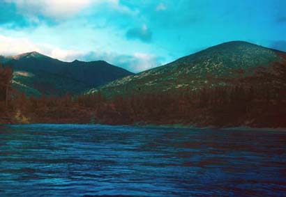
In the Kolyma drainage there are high mountains and vast, marshy tundra plains. Mountainous territories
are grown by the larch forest; the areas above 3000 feet over the sea level are covered by stone-pine and
bush alder, or by the mountainous tundra. The climate in the whole drainage is very harsh and cold. Not far
to the east, in the sources of the Indigirka River, there is the Pole of Cold of the northern Hemisphere.
In Upper Kolyma every winter the temperatures are below -50*C and even -60*C. Absolute minimum in this area
is below -70*C! Summer is short and often hot, with limited precipitation.
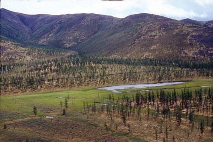
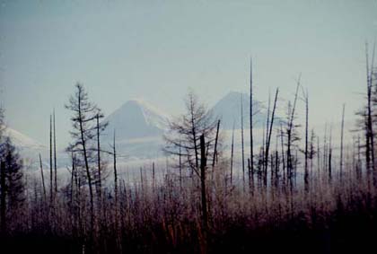
Typical
landscape of the Upper Kolyma (Omolon River valley)
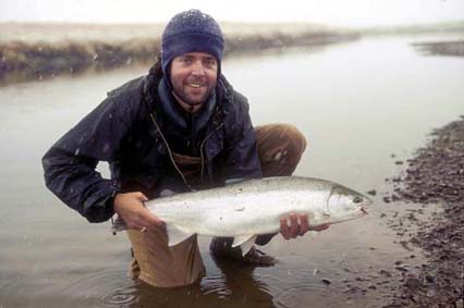
Many of the Kolyma tributaries are big rivers. The most
interesting sport fishes in the upper (salmonid) parts of rivers are lenok (only the sharp-nose species) and
Arctic grayling. Siberian taimen and blunt-nose lenok are totally absent in the Kolyma drainage, you could
find these species further west and south. In deeper and slower parts of streams you can fish for inconnu,
huge Northern pike, different whitefishes, and yellow perch. In many mountainous lakes dwell Arctic grayling
and resident charr.
Korkodon River
This river drainage is among the least accessible places in the Kolyma drainage. Korkodon is 460 miles long
and flows in a long arc to the north and east through the larch forest and mountains of the Kolyma Highland.
The river has no resident human population, and clear water. It has wide valley with a flat bottom and braided
river channels. Gravel and pebble bars and islands are covered by the floodplain forest of tall poplar and
Korean willows. The valley slopes are and river terraces are grown by larch forest; at the higher elevations
prevail dwarf stone-pine.
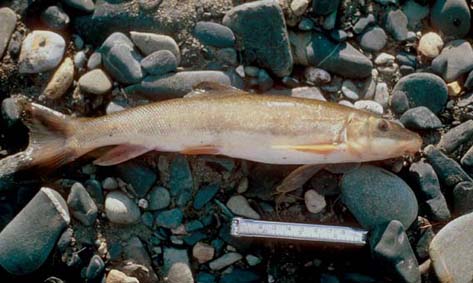
Kolyma
is one of the few drainages in Siberia which hosts longnose sucker
The most numerous sport-fish of the upper and middle reaches of Korkodon are Arctic grayling and lenok. The
lower reaches of the river are slower; this area is famous by big Northern pike and trophy yellow perch. In
this area it is possible to catch inconnu, but it is not numerous. The route will end in the mouth of the
river – on the wide Kolyma. Here you can “hitch-hike” a river barge. From here the tourists can go south,
upriver – to Seymchan village, connected by a dirt-road with Magadan. If you go north (down the Kolyma River),
the first town will be Zyryanka; from over there you can fly to Yakutsk and then to Moscow or Khabarovsk.
One
of the channels of the Upper Omolon River
Omolon River
Almost everything what was written about Korkodon (including information on fish
fauna) is correct about Omolon
as well. It is the next big river east from Korkodon, flowing north-east, north and north-west, and joining
the Kolyma in its lower reaches. Omolon is twice bigger than Korkodon – it is over 700 miles long. The upper
two thirds of the Omolon are rather fast. There is a small Omolon village in the middle reaches of the river,
and tiny Mandrikovo mining town further downstream. The most part of this huge drainage is uninhabited.
To the upper reaches of Kolyma you should go through Magadan. The easiest way to its middle reaches is via
Yakutsk and Zyryanka, and to the mouth – via Yakutsk and Cherski. Some of the Kolyma tributaries are especially
interesting for rafting. So, the boisterous Omulyovka, rushing through beautiful canyon, is rated 4. The best
fishing in the drainage you will find in big right tributaries – Omolon and Korkodon. The fish-fauna of the next
big river from Kolyma to the west, Indigirka, is almost the same as in Kolyma.
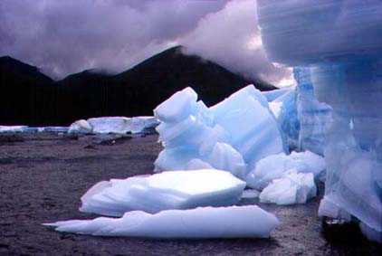
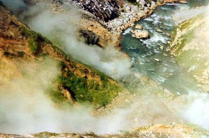
In
the Kolyma River drainage there are many ice-crusts.
This
ice is formed in river valleys during long winter and will not melt till mid
summer or fall.
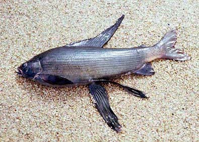
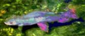
In
the Jack London Lake it is possible to catch a very strange-looking grayling.
Koryak
Highland or Koryakia

Ichiginnyvayam
River to the west from Tilichiki (Korf) town.
Koryak Highland is a system of numerous glaciated ridges, situated north from the Kamchatka Peninsula, to the south of Anadyr River. Many streams of this hard-to-reach region were never visited by foreign sport-fishermen.
Climate if this area is harsher than in the peninsula. It is more close to continental and has cool, short summer and long winter. The air temperatures and amounts of snow here are lower comparing with Kamchatka. Together with the northern part of the peninsula this area belongs to the territory of Koryak Authonomus Okrug. Eastern part of the highland you could reach by dome4stic flight from Petropavlovsk-Kamchatski to Korf (Tilichiki). Northern part of Koryak Highland is part of Chukotka.
The rivers of the Koryak Highland which flow into the Bering Sea host stocks of chinook, sockeye, chum and pink salmon, Arctic grayling, Dolly Varden charr, Northern pike, and round whitefish.
Kamchatka
Peninsula
The
tallest volcanoes of Kamchatka - Klyuchavskaya Sopka (left) and Kamen.
The Western fly-fishing community is only starting to discover Kamchatka Peninsula, one of the best trout fishing regions of the world! Kamchatka at the map looks like a fish which is dangling head-down from north-eastern Asia into the Pacific. This big peninsula is over 1000 km long, with lots of natural wonders. Thirty active and hundreds of extinct volcanoes create completely unique relief. The biggest and most active volcano in Asia, Klyuchevskaya Sopka, is almost 16,000 feet tall.
Kamchatka has geysers, thousands of warm and hot springs, and even one acid lake. Region has mild, rather warm climate, long and snowy winter. At the sea coasts the weather in summers is often foggy and rainy. The forests of Kamchatka consists mostly of stone-birch; in its center, in the valley of the biggest on the peninsula Kamchatka River there is a “conifer island” – forests of larch and spruce. Along the west coast, washed by cold and foggy Sea of Okhotsk, there is a band of treeless tundra. Kamchatka has literally hundreds of world-class rivers; it is impossible to describe all of them even in a separate book about the peninsula.
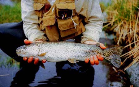
Rainbow
trout from the Bystraya River (Bolshaya River drainage)
Mild climate, abundant precipitation, and porous volcanic soils determine wealth of ground water and springs. This makes the peninsula especially favorable for reproduction of salmon, which are spawning in more than 1000 rivers. In many lakes there are spawning grounds of sockeye and coho. Numbers of salmon on some years can be simply astonishing: in Bolshaya River there were entering up to 10 million pink salmon! The most attractive fish species in Kamchatka are native rainbow trout, steelhead, and chinook (king) salmon. Besides these species, here you can catch coho, chum, pink, cherry and sockeye salmon, kundsha (whitespotted charr), Dolly Varden charr, and Arctic grayling. Think about this: in many rivers you can catch all of these 10 species of native wild Salmonids.
Southern and central parts of the peninsula belong to the territory of Kamchatka Oblast (territory) with its capital Petropavlovsk-Kamchatski. The north of the peninsula and adjoining parts of the mainland (region 6 and south of region 4) belong to the territory of Koryak Authonomus Okrug.
Kamchatka
steelhead from the Snatolvayam River
Everybody who wants to come to the peninsula will be flying to Elizovo airport, situated not far from Petropavlovsk. From here there is only one road to the west cost – to Bolshaya River drainage and Sea of Okhotsk. A branch of this road goes north, along the Bystraya River (tributary to Bolshaya). It crosses low divide and goes further north along the Kamchatka River to the town of Ust-Kamchatsk in its mouth. Other parts of Kamchatka you can reach only by air or sea.
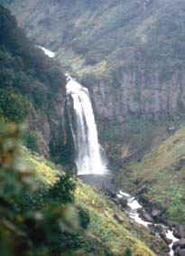 Waterfall at the Vilyucha River
Penzhina
Inlet
North-eastern corner of the Sea of Okhotsk is called Penzhina
inlet. This area has the biggest tides in Russia – their amplitude can reach 40
feet. Shores of this inlet belong to the territory of Koryak Authonomus Okrug. The capital of the territory is
Kamenskoe, where you can fly from Petropavlovsk. Several big rivers drain into the Penzhina
Inlet: Paren and Penzhina, flowing from the north-west, and the streams of south-western part of Koryak
Highland, which flow into Penzhina and Talovka.
Penzhina
River near the Khiusnaya River mouth
The fish fauna of this zone is rather similar to Anadyr River. Here you can fish for chum salmon, Arctic grayling, Dolly Varden and yellow-mouth charrs, Northern pike, different whitefishes. The salmon species with long freshwater period (coho, chinook, and sockeye) are absent here. These salmon species do not like rivers with species-rich fish communities.
The biggest river of the area is Penzhina; it is 250 miles long. Floating this mighty, almost not populated river is not difficult (it is rated 2). This drainage is one of few where rare Levanodov’s charr (yellowmouth charr) is spawning.
Another big watershed drainage of the area is Talovka. This river drainage has big, shallow Talovskoe Lake in the source of one of its tributaries, Kuyul. The river and lake are rich with whitefishes and big northern pike. In both Penzhina and Talovka is found an endemic species of whitefish – Penzhina cisco.
Paren River is famous by its grandiose canyon thousands feet deep. This river and especially its tributary Kolymak are home of big, 4-5 pound Arctic grayling. Other sport-fishes of the drainage are chum and pink salmon, and round whitefish. Big and deep Parenskoe Lake is populated by trophy
Arctic grayling, big Northern pike, and burbot.
Beginning
of the article
Last
part of the article
Articles
posted at this website
Fishing
Flies
Books & Articles
Fishing tours
About the
author
FLYFISHING, OUTDOOR TRIPS, WILDERNESS PHOTOGRAPHY